
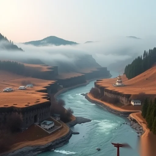
How to Explore Tan Gorge Without Getting Lost or Overwhelmed? A Step-by-Step Travel Guide
Seasonal Travel
Govoyagenow
If you are planning a trip to Tan Gorge, the most practical way to enjoy it is to start from the south trailhead before sunrise, follow the marked canyon route clockwise, and use a downloadable offline map to avoid the three confusing side ravines. This approach saves you at least two hours of backtracking and gives you the best lighting for photos.
Most people who visit Tan Gorge for the first time feel excited but also a bit anxious. The gorge is narrow in some parts, wide in others, and the trail signs are not always clear. You might see a beautiful side path that looks promising, but twenty minutes later you realize it leads to a dead end or a very steep climb that is not suitable for casual hikers. This happens because the gorge was originally formed by ancient water flows, and over time, smaller streams carved their own separate channels. The main canyon has a distinct reddish-brown rock layer, while the side ravines have darker, moss-covered stones. Once you learn to spot this difference, you will never take a wrong turn again.
So here is the step-by-step method that works for almost everyone. First, download a topographic map of the Tan Gorge area before you lose cell signal. Apps like Maps.me or Organic Maps allow you to download the entire region. Second, arrive at the south trailhead by 6:00 AM. The morning light filters through the canyon walls and creates a golden glow that disappears by 9:00 AM. Third, walk at a steady but not rushed pace. The main trail is about 7.5 kilometers from the south entrance to the north exit. Most people complete it in three to four hours, including short breaks for photos and water.
As you walk, keep an eye on the rock color. The correct path always stays on the reddish-brown stone. If you see dark gray or greenish rocks, you have probably stepped into a side ravine. Do not panic. Just retrace your steps for about fifty meters, and you will find the main trail again. The three confusing side ravines are locally known as Whisper Canyon, Fern Slot, and the Dry Fork. Whisper Canyon looks inviting because it has a small waterfall sound, but after ten minutes it becomes a dead end with a slippery rock face. Fern Slot has beautiful green plants hanging from the walls, but it leads to a steep drop that requires climbing gear. Dry Fork is the trickiest because it looks like the main trail continues, but it actually loops back to the start after an hour of walking.
Let me give you a real example from last month. A group of four hikers from Phoenix arrived at Tan Gorge around 10:00 AM. They did not have a map and followed the Dry Fork by mistake. They walked for an hour, realized they were back at the parking lot, and felt frustrated. They then tried the main trail but started at 11:30 AM under harsh sunlight. The heat reflected off the canyon walls, and they ran out of water by 1:00 PM. They had to turn back without seeing the famous Arch Window, which is the highlight of the entire gorge. On the same day, another solo hiker who started at 6:00 AM, used the rock-color rule, and carried two liters of water finished the entire trail by 10:30 AM, took fifty great photos, and was back in town for lunch.
What should you pack? Bring at least two liters of water, even on cool days. The canyon traps heat, and the humidity can be surprisingly high near the stream sections. Wear hiking shoes with good grip because some parts have loose gravel. A hat is useful only at the start and end of the trail, but inside the gorge, the walls provide shade for about seventy percent of the walk. Do not rely on phone signal. Even the best carriers lose connection once you are between the high walls. A power bank for your phone is smart because using the GPS function drains the battery faster than usual.
The best season to visit Tan Gorge is from late September to early November or from mid-April to early June. In summer, afternoon thunderstorms can cause flash floods in narrow canyons. Always check the weather forecast for the upstream area, not just the gorge itself. Rain falling twenty kilometers away can send a surge of water down the canyon with almost no warning. If you hear thunder or see the stream turn muddy, turn back immediately and head for higher ground.
For photography, the best spots are at the first bend after one kilometer (morning light hits the wall directly), at the Arch Window around kilometer four (stand ten meters back to frame the sky through the arch), and at the final pool before the north exit (reflections of the cliff in calm water). If you use a smartphone, turn on the HDR setting to balance the bright sky and the dark canyon shadows. A small tripod helps for long-exposure shots of the small waterfalls.
One more practical tip: use the restroom at the trailhead before you start. There are no facilities inside the gorge. Pack out all your trash, including fruit peels and toilet paper. The canyon ecosystem is fragile, and the narrow passages mean that litter stays visible for a very long time.
After you exit at the north end, you have two options. You can walk back along the ridge trail, which is about six kilometers and takes two hours, or you can call the local shuttle service, which runs every hour from 11:00 AM to 4:00 PM. The shuttle costs eight dollars per person and drops you at the south parking lot. The ridge trail offers different views of the canyon from above, but it has almost no shade, so only take it if you have extra water and sun protection.
Following this method—early start, offline map, rock-color rule, and proper packing—turns Tan Gorge from a confusing maze into a rewarding half-day adventure. You will see the main highlights, avoid the frustrating dead ends, and finish with energy to spare.
(Just came back from Tan Gorge yesterday. The rock-color tip is a lifesaver. I took the Fern Slot by accident and wasted 40 minutes. Wish I read this earlier.)
(I’ve hiked there three times and never realized the red vs dark gray rock trick. Tested it today and stayed on track the whole way. Thank you for this detail.)
(What about camping inside the gorge? Is that allowed? I didn’t see any signs about camping rules.)
(No camping allowed inside the main canyon. Rangers check regularly. There’s a designated site one kilometer before the south trailhead though.)
(The Arch Window at 6:30 AM is pure magic. Your lighting advice is spot on. Got shots that look like professional landscape photos.)
Simple rules, early start, watch the rock color — enjoy Tan Gorge without the stress.
FINISHED谭峡谷旅行指南生成




5 Comments
Anonymous
03/07/2026
Just came back from Tan Gorge yesterday. The rock-color tip is a lifesaver. I took the Fern Slot by accident and wasted 40 minutes. Wish I read this earlier.
Anonymous
03/07/2026
I’ve hiked there three times and never realized the red vs dark gray rock trick. Tested it today and stayed on track the whole way. Thank you for this detail.
Anonymous
03/07/2026
morning light hits the wall directly
Anonymous
02/07/2026
stand ten meters back to frame the sky through the arch
Anonymous
02/07/2026
reflections of the cliff in calm water