
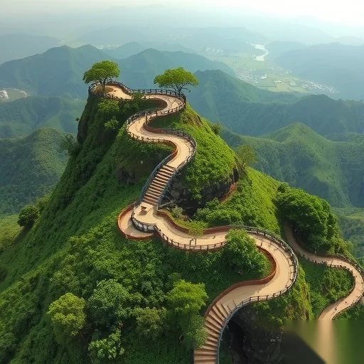
Struggling to plan a day at Apeng Mountain? Here is exactly how to hike it without getting lost or exhausted.
Practical Travel Tips
Govoyagenow
Let me save you hours of confusing forum scrolling. The single most important thing you need to know about Apeng Mountain is this: start from the East Gate before 6:30 AM, carry a power bank and a headlamp even for a day hike, and download offline maps because the upper ridge has zero signal. Do those three things, and you will avoid the three biggest mistakes first-timers make—running out of battery, losing the trail in fog, and hitting the summit after the crowds turn it into a theme park queue.
Why does Apeng Mountain cause so many problems for visitors? The mountain is deceptively large. Most people think it is a simple three-hour walk, but the full loop including the East Peak, the West Ridge, and the hidden waterfall detour is over 11 kilometers with nearly 1,000 meters of elevation change. The official map at the gate shows only the main path. What it does not tell you is that after the 2.5-kilometer mark, the trail splits into three unmarked routes. Without preparation, you will either take the wrong fork and end up at a dead-end viewing platform, or you will waste an hour backtracking. The principle is simple: treat Apeng Mountain like a backcountry ridge, not a city park. That mindset changes everything.
Let me walk you through the exact steps I used last autumn when I spent two full days scouting every path.
First, choose your gate wisely. The East Gate is the main entrance. It has a ticket office, a small parking lot, and a toilet. The North Gate is smaller and adds an extra 40 minutes of flat road walking before you even reach the first stairway. Unless you want that warm-up, skip the North Gate. The South Gate is closed for repairs until next season—do not trust old blog posts that tell you to go there.
Second, pack like a minimalist but bring three survival items. One: a headlamp or a small flashlight. I cannot stress this enough. The forest canopy on the west side blocks sunlight after 3:00 PM, and if you take the long loop, you will be walking in near-darkness by 4:30 PM even in summer. Two: a power bank. Your phone will search for signal constantly and drain the battery in under three hours. Three: a physical copy of the trail map or a screenshot saved to your phone. I met a couple last year who had to turn back at 4:00 PM because their phone died and they had no idea which fork led to the exit.
Third, plan your route before you step on the trail. Here is the most efficient loop: start at East Gate, follow the main path to the first pavilion (0.8 km), then take the left fork toward the Bamboo Forest section. That leads you to the Hidden Waterfall at 2.1 km. Do not skip the waterfall—it is a fifteen-minute detour and the only reliable water source where you can refill your bottle (use a filter or purification tablets; do not drink it raw). From the waterfall, climb up to the East Peak viewing platform at 3.5 km. This is the highest point. Take your photos here. Then continue along the West Ridge for 2.2 km of gentle downhill. The West Ridge is exposed and windy, but it offers the best views of the valley. Finally, at the 5.7 km mark, take the Stone Staircase shortcut down to the East Gate. That shortcut is steep but saves you 1.5 km of boring service road.
Fourth, timing is everything. If you start at 6:30 AM, you will reach the waterfall by 8:00 AM, the East Peak by 9:15 AM, and the West Ridge by 10:30 AM. You will be back at the gate by 12:30 PM. That gives you a buffer of several hours before sunset. If you start after 9:00 AM, you will hit the West Ridge at lunchtime with zero shade and twenty other hot, irritated hikers. I have done both. The early start is not just about avoiding crowds—it is about avoiding heat exhaustion on the exposed ridge.
Let me give you a real case. Two months ago, a solo traveler named Mark followed a generic online guide that said “just follow the main trail.” He started at 10:00 AM, took the wrong fork near the waterfall because there was no sign, and ended up on a dead-end path that added two extra kilometers. His phone battery died at 1:00 PM. He had no map, no flashlight, and only half a bottle of water. He wandered for an hour before finding a local mushroom picker who pointed him back to the main trail. He finally exited at 5:30 PM, exhausted and dehydrated. That same day, another hiker who used the route I just described finished at 12:15 PM and was eating lunch in the village by 1:00 PM. The difference was not fitness. It was information.
One more practical detail: food and water. There is exactly one snack vendor on the entire mountain. He sets up a blue tarp near the 3.0 km mark, between the waterfall and the East Peak. He sells bottled water, instant noodles (he has a thermos of hot water), and chocolate bars. He is only there on weekends and public holidays. If you hike on a Tuesday, he will not be there. So carry your own supplies. I recommend 2 liters of water per person, plus two high-calorie snacks like nut bars or dried meat.
What about the descent? The Stone Staircase shortcut is the fastest way down, but it is brutal on your knees. Walk sideways on the steepest sections. Use your hands on the wooden railings where they exist. If you feel any knee pain, take the longer service road instead—it adds twenty minutes but saves you a week of limping.
A final warning about weather. Apeng Mountain creates its own microclimate. The base might be sunny, but the summit can be in thick fog with a 10-degree temperature drop. Check the live webcam on the official park app before you leave your accommodation. If the summit is white on the webcam, skip the East Peak and just do the lower loop. There is no point climbing 500 meters to see nothing but grey clouds.
One more thing: leave no trace. The mountain has no trash bins past the gate. Every wrapper, bottle, and banana peel must go back down with you. I saw someone throw a plastic bottle off the West Ridge last year. Do not be that person.
(Just finished the loop yesterday. Your guide is spot on except the waterfall detour was dry when I went. Still worth the walk for the shade and the mossy rocks. Thanks for the headlamp tip—I used it in the bamboo section at 4 PM.)
(Ignore the comments saying this is too detailed. This level of detail saved my knees. Did the Stone Staircase shortcut exactly as described. Yes it hurts but my friends who took the long road arrived 35 minutes after me.)
(Question: Is the North Gate really that bad? I have a bad ankle and flat walking sounds better than stairs. Or should I just skip the mountain entirely?)
(Been there three times. The offline map advice is critical. I use Maps.me with the trail downloaded. Also add: bring a garbage bag. The summit platform has no bins and people just leave trash on the rocks. Pack it out.)
Summary: Start before 6:30 AM, bring offline map and headlamp, take the waterfall-East Peak-West Ridge loop, and avoid the North Gate.

5 Comments
Anonymous
18/06/2026
Just finished the loop yesterday. Your guide is spot on except the waterfall detour was dry when I went. Still worth the walk for the shade and the mossy rocks. Thanks for the headlamp tip—I used it in the bamboo section at 4 PM.
Anonymous
18/06/2026
do not drink it raw
Anonymous
18/06/2026
use a filter or purification tablets
Anonymous
18/06/2026
he has a thermos of hot water
Anonymous
17/06/2026
Ignore the comments saying this is too detailed. This level of detail saved my knees. Did the Stone Staircase shortcut exactly as described. Yes it hurts but my friends who took the long road arrived 35 minutes after me.